Geospatial Foundation Model–Supported GeoAI for Building-Footprint Mapping
Examines the use of high-resolution UAV imagery and GeoFM embeddings for object-level building-footprint mapping and validation.
- Research focus
- Use broader semantic and geographic context to reduce uncertain building detections while preserving detailed UAV-derived boundaries.
- Methods & data
- UAV RGB imagery · GeoFM embeddings · multimodal feature integration · building-object validation.
- Current stage
- Ongoing · framework development and experimental design.
Research rationale and objective
Research overview
UAV imagery supplies fine boundary detail, while GeoFM embeddings provide broader semantic and geographic context. The study tests whether combining both sources reduces false detections across different settlement environments.
Problem context and research need
Accurate building-footprint information supports urban planning, infrastructure management, disaster-risk assessment, settlement analysis, population estimation, and geospatial database development.
UAV imagery provides highly detailed spatial information, yet RGB-based extraction models can confuse buildings with visually similar surfaces such as roads, concrete areas, bare land, shadows, vegetation, and other artificial objects. Performance may also vary across dense urban areas, rural settlements, and geographically different environments.
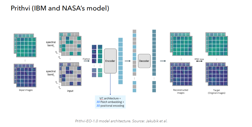
Geospatial foundation models offer broader Earth-observation knowledge, but their representations are generally coarser than UAV imagery and cannot directly replace detailed object geometry. The research therefore treats the two sources as complementary rather than interchangeable.
Conceptual direction
Fine-scale boundary preservation. Retain the detailed spatial and geometric information provided by high-resolution UAV imagery.
Context-aware assessment. Examine semantic, geographic, and neighbourhood context from geospatial foundation-model representations during candidate-building assessment.
Methods and current progress
Work presently under development
| Research component | Current focus |
|---|---|
| Conceptual framework | Development of the multi-resolution research framework and evaluation logic. |
| Data preparation | Preparation of UAV imagery and geospatial foundation-model data. |
| Candidate generation | Development of building-candidate preparation and object-level representation. |
| Context representation | Object-level foundation-model features and multi-scale spatial-context representation. |
| Comparative modelling | Design of comparative intelligent-modelling and validation frameworks. |
| Evaluation planning | Spatial and temporal validation planning and experimental preparation. |
Contribution and applications
Research evaluation focus
- Measure changes in false building detections and uncertain-candidate identification.
- Assess preservation of UAV-derived building-boundary geometry.
- Evaluate the contribution of foundation-model representations to object-level mapping.
- Examine the effect of geographic and neighbourhood context on candidate assessment.
- Compare performance across different settlement environments.
- Document the resulting workflow and evaluation procedure.
Possible domains of use
- Multi-resolution building-footprint mapping
- Cross-settlement model transfer
- Rural and informal-settlement mapping
- Building-database updating
- Exposure and population mapping
Research responsibilities
- Multimodal research-framework design
- UAV building-candidate preparation
- GeoFM embedding acquisition and analysis
- Object- and neighbourhood-level feature integration
- Comparative modelling and spatial validation
- Model comparison, interpretation and manuscript preparation