Spatially Representative Training-Sample Selection for Large-Area Satellite Imagery
Selects distributed reference areas that preserve the landscape diversity of a much larger satellite-image extent.
- Research focus
- Reduce annotation effort and sampling bias without losing geographic representativeness.
- Methods & data
- High-resolution satellite imagery · spatial grids · spectral, land-cover and landscape diversity · distributed sampling.
- Current stage
- Ongoing · method development, representative-feature design and testing.
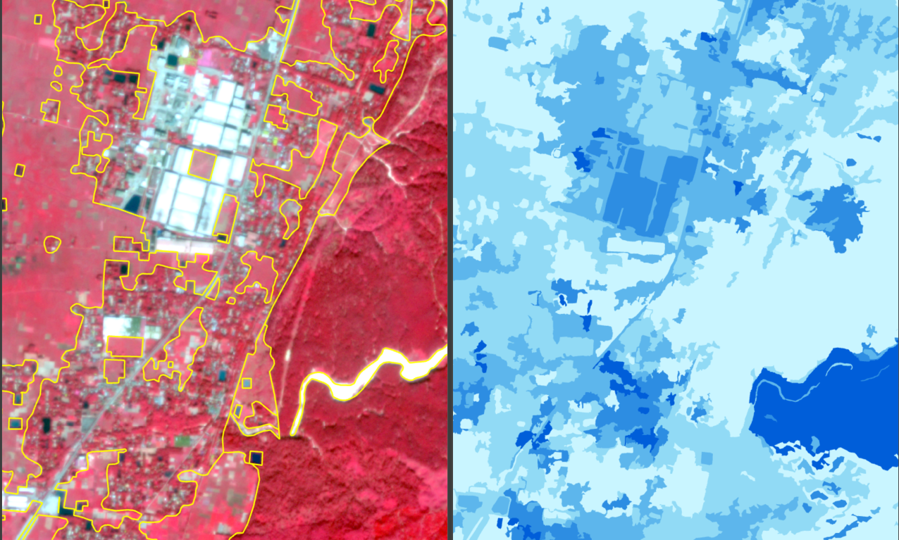
Research rationale and objective
Research overview
The study compares candidate areas using spectral, land-cover and landscape diversity, with the goal of selecting approximately 100 km² from a 600 km² high-resolution image.
Problem context and research need
Preparing detailed reference data across large satellite-image extents requires substantial time and manual effort.
Training areas selected only through visual judgement or convenience may fail to represent the full diversity of a study region. This can introduce sampling bias and limit geographic representation during model training and evaluation.
The research therefore explores a systematic approach for identifying a smaller and more representative reference subset without requiring annotation across the entire image.
Conceptual direction
Efficient reference preparation. Reduce the spatial extent that requires detailed annotation while retaining broad study-area representation.
Geographic representation. Select distributed reference areas that collectively reflect spectral, spatial, land-cover, and landscape diversity.
Methods and current progress
Work presently under development
| Research component | Current focus |
|---|---|
| Conceptual framework | Development of the representative-sampling research framework. |
| Image preparation | High-resolution satellite-image and spatial-grid preparation. |
| Variable identification | Identification of variables that may represent spatial and landscape diversity. |
| Sampling strategy | Development of the distributed reference-area selection strategy. |
| Evaluation planning | Experimental design and evaluation preparation. |
Contribution and applications
Research evaluation focus
- Quantify the reduction in reference-area annotation requirements.
- Assess spatial representation across the larger image extent.
- Compare sampling bias under alternative reference-area selection strategies.
- Evaluate model performance when training data are drawn from the selected subset.
- Examine the trade-off between annotation extent and geographic coverage.
- Document the selection and evaluation procedure.
Possible domains of use
- Training-area selection for large satellite scenes
- Efficient annotation planning
- Geographically balanced reference-data design
- Model-transfer evaluation
- Large-area remote-sensing mapping
Research responsibilities
- Spatial sampling-strategy design
- Satellite-image and diversity-feature preparation
- Candidate-area selection and comparison
- Experimental evaluation and interpretation
- Figure and manuscript preparation